


 CRITICAL FIRE WEATHER CONDITIONS POSSIBLE THURSDAY AFTERNOON AND EVENING FOR SOUTH-CENTRAL NEW MEXICO AND FAR WEST TEXAS... .A deep upper level trough moving across the Four Corners region will induce deepening low pressure over southeast Colorado Monday afternoon. As the pressure gradient tightens, and deep mixing occurs, southwest winds of 30 to 45 mph with gusts to 55 to 65 mph will develop. Meanwhile, a dry air mass will be lingering across region. The combination of low humidity and strong winds will lead to dangerous fire weather conditions in the Red Flag Warning area on Thursday.
...RED FLAG WARNING IN EFFECT FROM NOON TO 7 PM MST THURSDAY FOR STRONG WINDS, LOW RH VALUES, AND CRITICALLY DRY FUELS FOR NMZ111...
The National Weather Service in El Paso Tx/Santa Teresa has
issued a Red Flag Warning for portions of southwestern New
Mexico, which is in effect from noon to 7 PM MST Thursday.
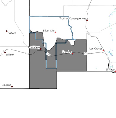
* AFFECTED AREA...Fire Weather Zone 111 Southwest Deserts and
Lowlands/Las Cruces BLM/GLZ.
* TIMING...Thursday afternoon through Thursday evening, 12 PM to
7 PM.
* WINDS...Southwest 25 to 35 mph with gusts up to 55 mph.
* RELATIVE HUMIDITY...As low as 12 percent.
* TEMPERATURES...Up to 70.
* EXPERIMENTAL RFTI...5 to 7 (on a scale out of 10).
* IMPACTS...Any fires that develop will likely spread rapidly.
Outdoor burning is not recommended.
PRECAUTIONARY/PREPAREDNESS ACTIONS...
A Red Flag Warning means that critical fire weather conditions
are either occurring now, or will shortly. A combination of
strong winds, low relative humidity, and warm temperatures can
contribute to extreme fire behavior.